Turning Satellite Data Into Smarter Grazing Decisions: Cibo Labs at Clear Creek by Elders
Thanks to Elders for sharing this amazing case study on the AFM and PastureKey with Cibo Labs.
4 min read
|
"I think having access to the satellite mapping gives us a lot more confidence in our decisions. You’re less likely to get caught out if you’re just relying solely on visual inspections." - Lauren Schelberg, LJ & SA Schelberg, Maranoa Region QLD |

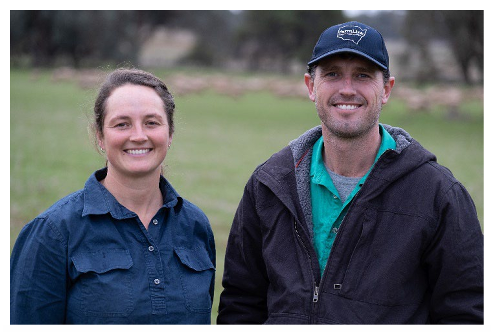
Running a dual-enterprise operation across 11,400 hectares in southwest Queensland’s Maranoa region is no small task. Lauren Schelberg manages 500 breeding cattle and 2,000 Dorper ewes alongside her husband on their family property, LJ & SA Schelberg, located southwest of Muckadilla. The country is typical of the region, variable in its response to rainfall and unforgiving when seasons turn.
Before using any satellite-based pasture tool, feed budgeting and stock movement decisions were made almost entirely by feel. “Not very well,” is how Lauren herself describes it. It was a process of walking paddocks, reading the country, and going on instinct, a method that works well enough in a good season, but one that offers little defence against being caught out when things start to tighten.
The challenge was particularly acute during dry spells when managing where to move breeders with young calves. With animals at a vulnerable stage and feed becoming patchy, the margin for error shrinks and the cost of a wrong call, overgrazing a paddock or moving stock too late, can be significant. What Lauren needed was a way to see beyond what was immediately visible and plan ahead with more confidence.
Lauren’s introduction to the Australian Feedbase Monitor came through MLA’s announcement of free access to satellite imagery for producers. The concept, being able to see the state of your feedbase from above, across all paddocks, without having to physically be there, was immediately appealing for an operation spread across multiple areas.
Her initial use of the free AFM tool was exploratory, checking it against what she was seeing on the ground and building confidence in the data over time. The tool proved its worth, and Lauren took the step of purchasing a PastureKey subscription through Cibo Labs for greater paddock-level detail and more frequent updates. Today she uses both: AFM for the high-level total standing dry matter overview, and PastureKey where she needs finer resolution.
“The fact that it’s free is amazing,” she says of AFM. “When you’re always budget-conscious and working your cash flow, having access to a free program is pretty amazing.”
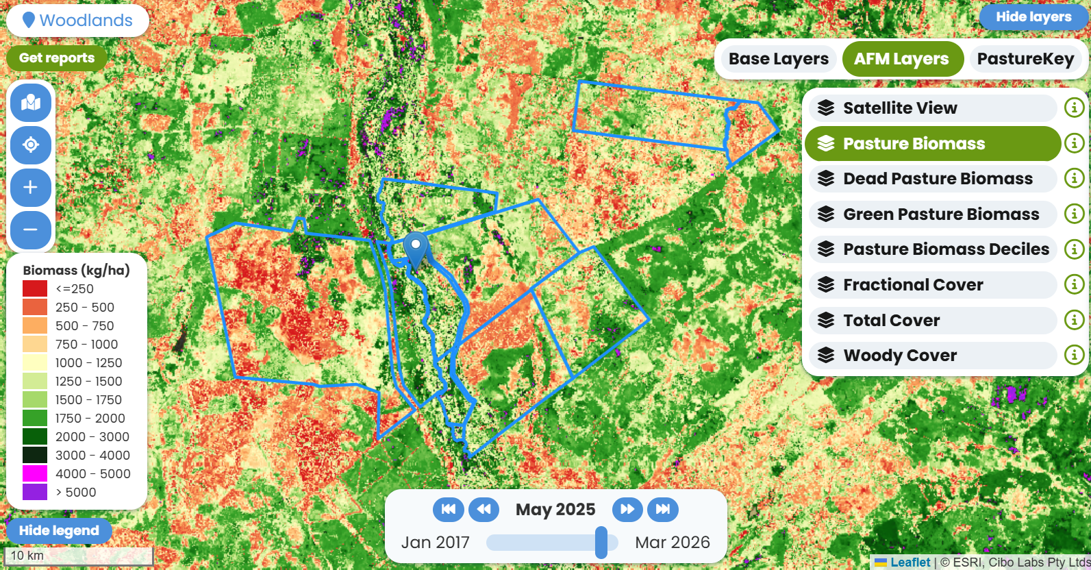
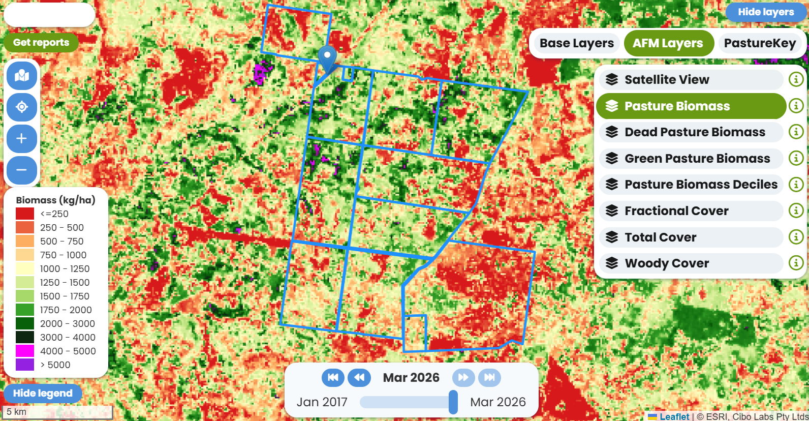
A Visual Language for Feed
One of the features Lauren values most in AFM is the total pasture biomass layer, specifically the colour coding that gives an at-a-glance read on where feed is across the property. Bright greens signal feed; as conditions tighten, the map reflects that shift. For a producer managing grazing across dispersed country, that spatial overview is invaluable.
“I like the initial look, the coloring it gives in terms of the overall total standing dry matter. Bright green is more feed, a bit more pink, it’s less. I was more confident in that being accurate,” she explains.
This is how AFM fits into her workflow: not as a replacement for boots on the ground, but as a complement to it. She logs in roughly once a month or every six weeks, usually prompted by something she’s observed in the paddock that she wants to verify or explore further.
Strategic Stock Movement Planning
The most concrete value AFM has delivered for Lauren is in planning stock movements, particularly for breeding cattle. At the end of last year, heading into a drying period, she used total standing dry matter data from AFM to decide which paddock her breeders and calves should move into next. With animals at a sensitive stage, getting that call right mattered.
|
"End of last year we were getting a little bit dry and I was thinking specifically about where to move the breeders who were having calves. Looking at the total standing dry matter from the Feedbase Monitor was helpful in making a decision about where to get the cattle into next." - Lauren Schelberg |
That ability to pre-plan, to look at the map and identify where feed is holding up before committing stock, has changed how the operation manages its grazing calendar.
Monitoring Sheep Grazing Patterns
For the sheep enterprise, AFM has provided an unexpected benefit: the ability to observe how Dorper ewes are grazing across a paddock, even when Lauren isn’t physically present. She can see grazing around water points, identify where paddocks are being eaten out, and adjust accordingly. It’s a window into animal behaviour that didn’t exist before.
“We can clearly see, we’ve got lambing ewes in use, we can see that they’ve eaten out around the water points, or they’re eating the rest of the paddock well. All things like that. So I think that’s been quite helpful.”
Lauren’s view of AFM is straightforward: it fills a gap that experience alone cannot. Visual inspection remains central to how she and her husband run the property, but the satellite data provides a layer of confirmation and occasionally a correction, that has made their decisions more grounded.
She is candid about how things worked before. “Not very well” is her summary of pre-AFM pasture monitoring. The contrast with now is not dramatic, it’s not that every decision has changed but the confidence underlying those decisions has. Knowing that the data supports what you’re seeing, or flagging something you might have missed, changes how you act.
When asked what she would say to other producers about AFM, her answer was unambiguous.
|
"Everybody should be using it, really. It gives you a visual representation of your feedbase and you can make strategic decisions about stock movements and future planning for potential dry times before they happen. You’re less likely to get caught out." - Lauren Schelberg |
With clear visibility across a mixed enterprise, AFM and PastureKey have helped the Schelberg operation move beyond reactive management to more confident, forward planning. The result is stronger decision-making across livestock and land, supporting both productivity and long-term resilience.
Thanks to Elders for sharing this amazing case study on the AFM and PastureKey with Cibo Labs.
"I think having access to the satellite mapping gives us a lot more confidence in our decisions. You’re less likely to get caught out if you’re...