What Your Best Paddocks Can Teach You
Every producer has paddocks they consider their best performers.
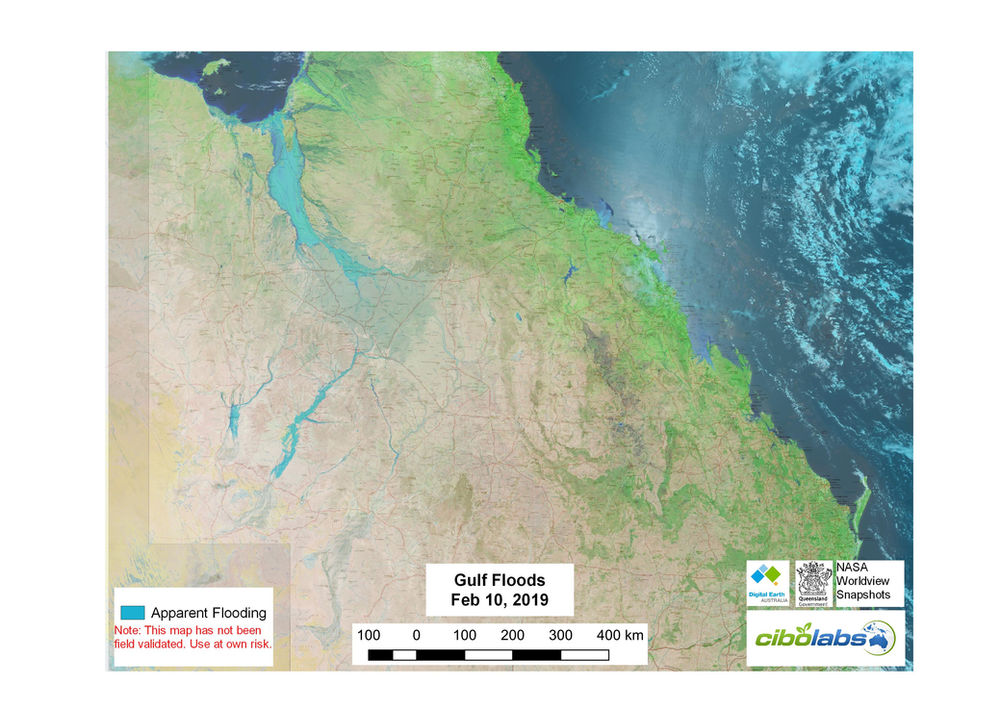
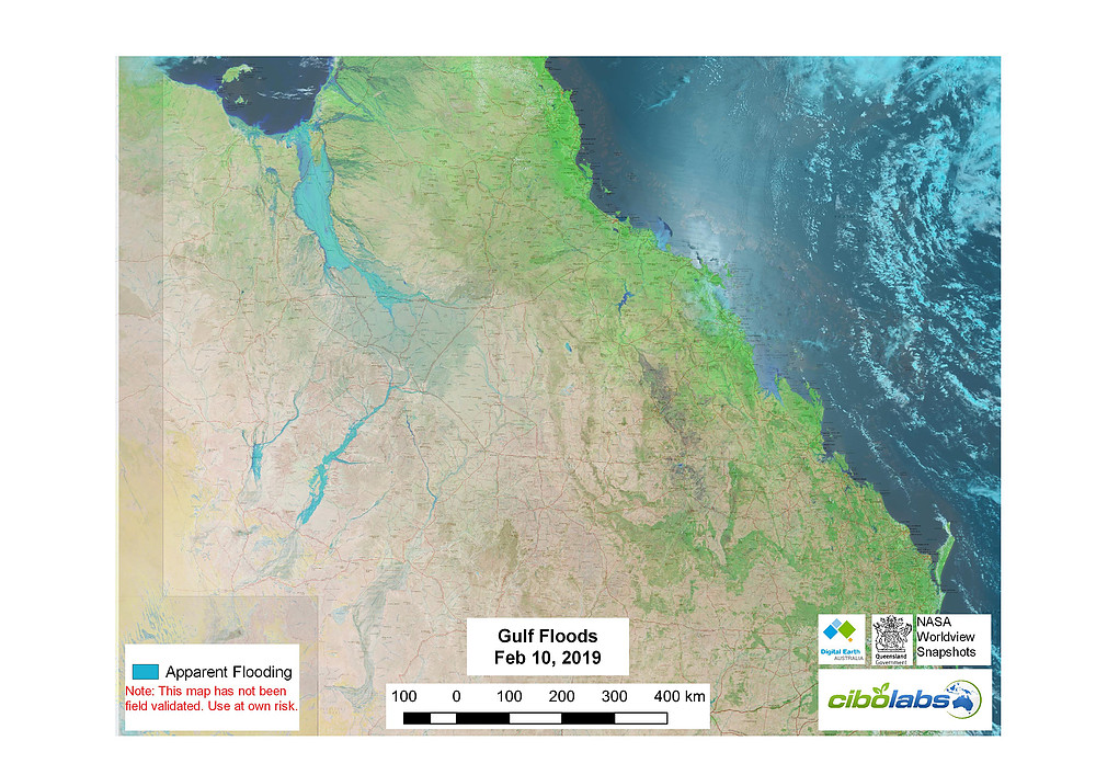
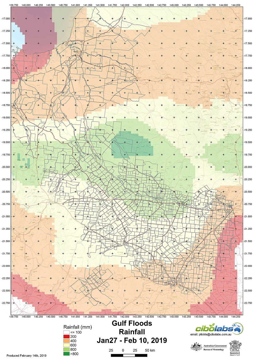
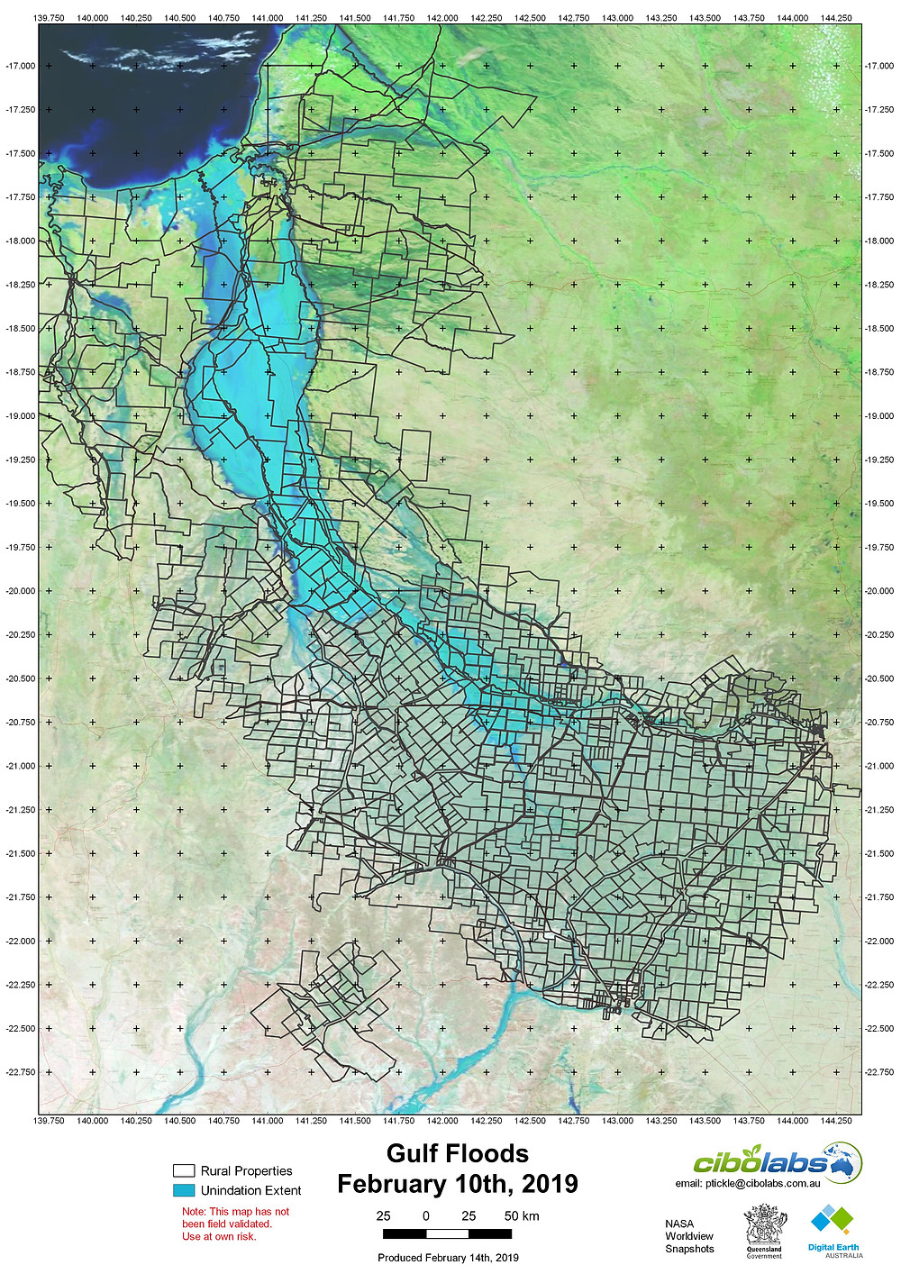
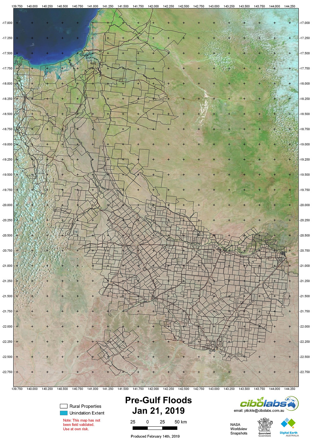
Imagery captured over the state on February 10th suggests that flooding has occurred over more than 100,000sqkm, potentially affecting more than 2000 land parcels on around 500 properties.
Higher resolution maps, a shapefile and spreadsheet of the potential properties affected can be downloaded here https://bit.ly/2SL5Bhf
Our thoughts are with all those involved.
Every producer has paddocks they consider their best performers.
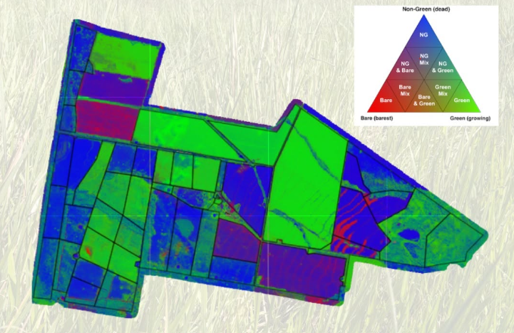
We all know the importance of keeping an eye on pasture. But by the time a change is obvious from the ute window or during a paddock inspection, it...
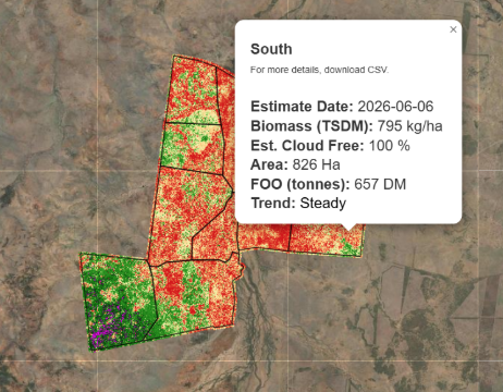
When it comes to pasture management, it’s easy to focus on a single number.