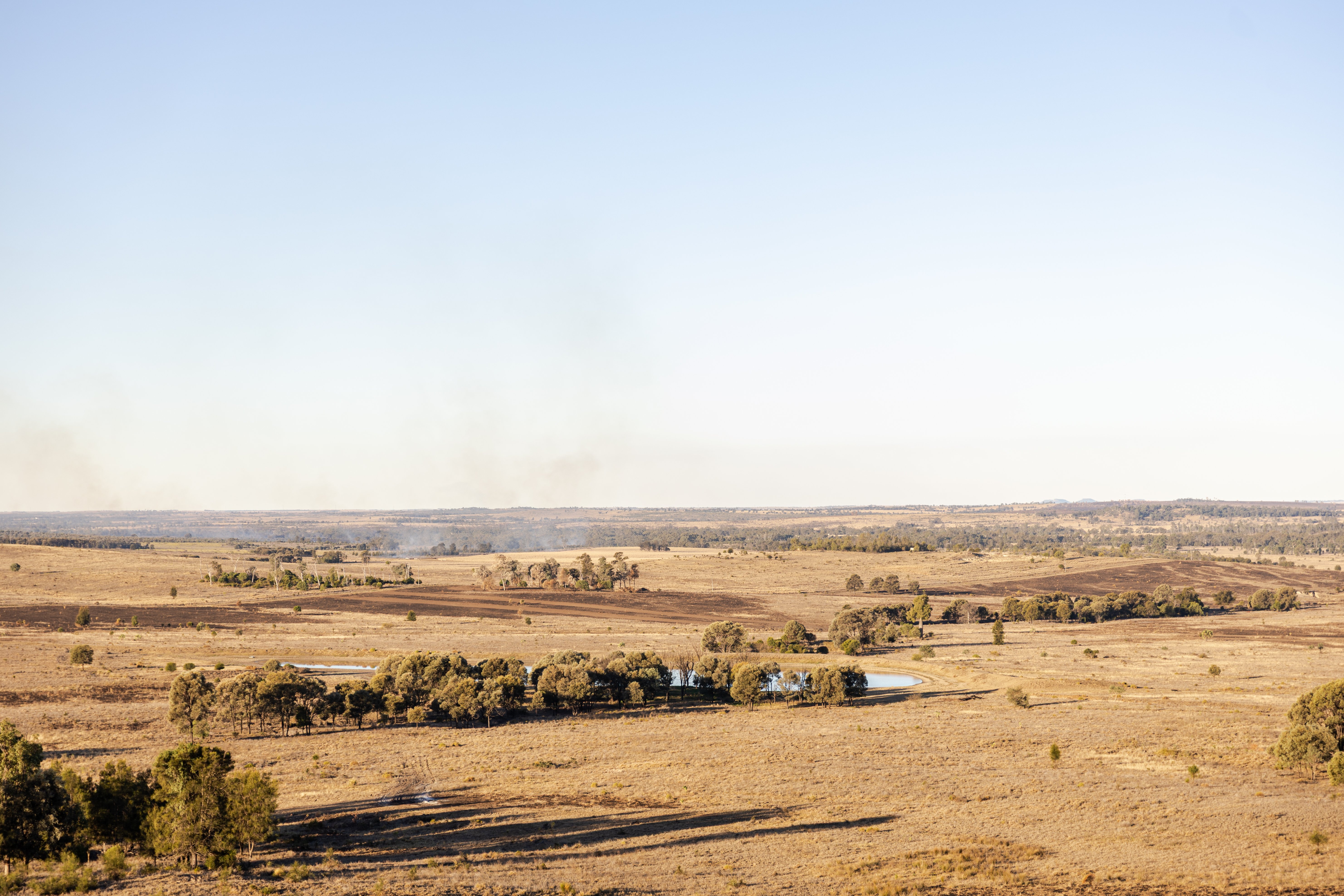
What Your Best Paddocks Can Teach You
Every producer has paddocks they consider their best performers.
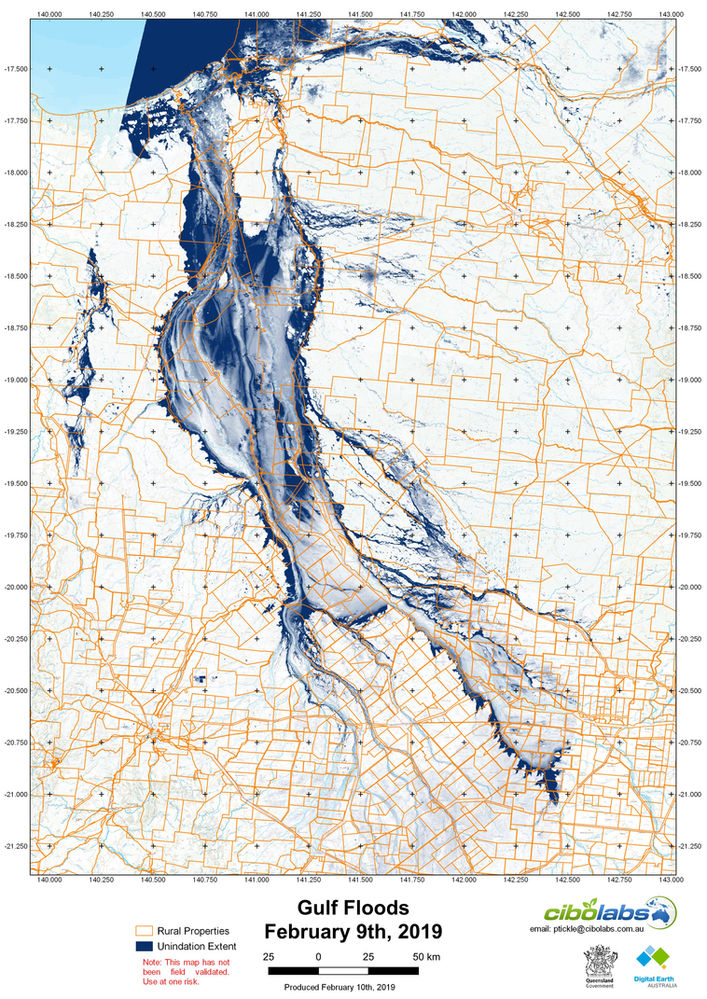
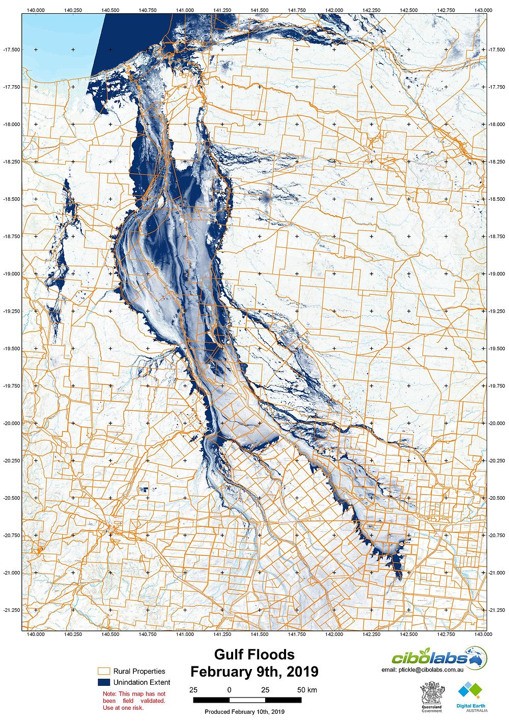
The maps are available as JPEG or GeoPDF to load into mapping software. Note the map has not been field validated. Download from here: https://bit.ly/2I3XjNk
Please contact us at email: ptickle@cibolabs.com.au or mob: 0437593037 if you need more information. Feel free to distribute.
Big Thanks to the Digital Earth Australia Team at Geoscience Australia for making the data so readily available.
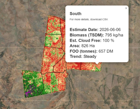
Every producer has paddocks they consider their best performers.
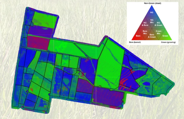
We all know the importance of keeping an eye on pasture. But by the time a change is obvious from the ute window or during a paddock inspection, it...
When it comes to pasture management, it’s easy to focus on a single number.